The item is in a remote warehouse, delivery time is 14-21 business days. More info
Delivery options - Select at checkout
Shipping @price - GLS
12,00
EUR
131,53
Incl. VAT 164,41
Total incl. delivery
179,41
The function requires that you are logged in. Create a user and use our smart list system to keep track of future purchases, regular purchases or wish lists. Create user Login

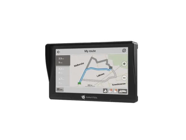
Reliable Linux operating system Based on the reliable and fast Linux operating system, NAVITEL E777 TRUCK will provide stable and smooth operation on any trip. The device will allow you to plot a route of any complexity with an unlimited number of waypoints, and the search is available not only by the address, but also by the base of useful objects: gas stations, banks, cafes and attractions.
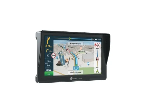
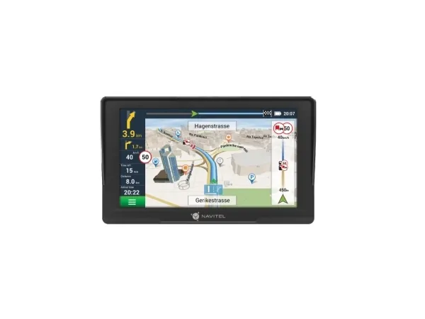
Precise navigation The driver receives all the necessary information for a safe and quick drive – three alternative routes, voice prompts, lane assistance, and notifications about speed cameras on the way. Navitel Navigator informs the user about speeding restrictions on each road segment and also notifies about speeding.
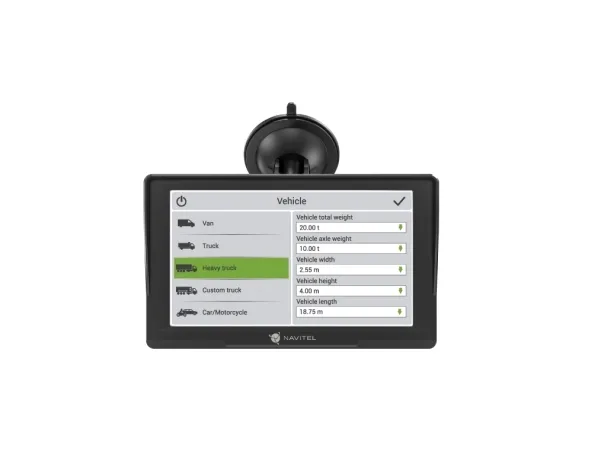
?argo graph The Navitel Navigator program pre-installed on the NAVITEL E777 TRUCK offers an extended set of settings for navigating heavy vehicles. Select the type of freight transport in the settings or create your own vehicle by adding its parameters: length, width, height, maximum permitted and actual weight, axle load, etc., and the program will build routes taking into account road restrictions for this type of transport, allowing you to travel freely to your destination.
Sun Visor The sunshield specially designed for this device improves the visibility of the map on the screen on a sunny day. At night, the sun visor will prevent the reflection of the screen of the device on the windshield, which increases the safety of the trip.
Offline maps The device includes a license for 47 maps, some of which are already loaded on the device. You can update the list of maps you need, remove unused ones, and install the necessary ones, as well as update the installed ones, using the Navitel Update Center program. To store map updates, as well as record trip tracks, may be required to install an SDcard
Marine (chartplotters, sounders)
No
Sport (fitness, running)
No
Outdoor (hiking, trekking)
No
Geocaching (GPS stash hunt)
No
Auto
Yes
Aviation
No
Bicycle
No
Motorcycle
Yes
Truck
Yes
Camper/Caravan
No
Golf
No
Lane guidance
Yes
Antenna
Internal
Maps included
Yes
Map coverage
Albania, Andorra, Austria, Belgium, Bosnia and Herzegovina, Bulgaria, Croatia, Cyprus, Czech Republic, Denmark, Estonia, Finland, France, Germany, Gibraltar, Greece, Hungary, Iceland, Italy, Latvia, Liechtenstein, Lithuania, Luxembourg, Malta, Moldova, Monaco, Montenegro, Netherlands, North Macedonia, Norway, Poland, Portugal, Romania, Russia, San Marino, Serbia, Slovakia, Slovenia, Spain, Sweden, Switzerland, Ukraine, United Kingdom
Number of countries covered
47
Display diagonal
17.8 cm (7")
Touchscreen
Yes
Widescreen
Yes
Display resolution
800 x 480 pixels
Storage media type
Flash
Compatible memory cards
MicroSDHC
Internal storage capacity
8 GB
RAM capacity
128 MB
Maximum memory card size
32 GB
Bluetooth
No
Built-in speaker(s)
Yes
Built-in camera
No
Processor model
MStar MSB2531
Processor frequency
800 MHz
Operating system installed
Linux
Form factor
Fixed
Product colour
Black
USB connectivity
Yes
Headphone connectivity
3.5 mm
Power source type
Battery
Battery technology
Lithium-Ion (Li-Ion)
Battery type
Built-in
Battery capacity
1600 mAh
The item is known under the following item numbers in our system
EAN:
8594181744386
SKU:
8594181744386
Why do I find that the same product is available on different item numbers?
Manufacturers often release the same product with different item numbers, typically just different versions of the packaging. For example, the packaging may be targeted at different countries.
We try our best to unify the products, but it can happen that the same product appears on different item numbers in our system.